
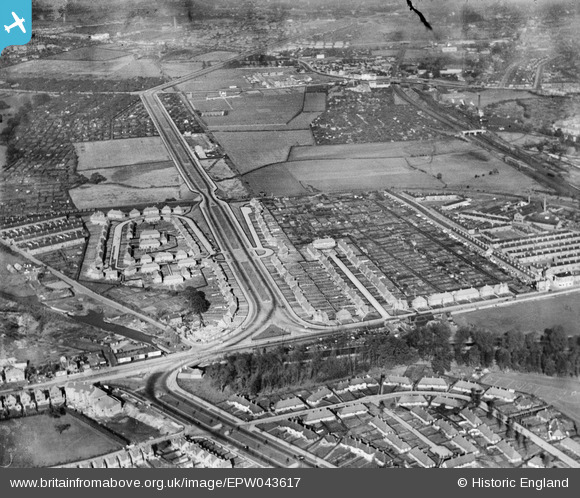
EPW043617 ENGLAND (1933). Housing at Southwold Drive, Marchwood Close and the Western Boulevard, Radford, 1933
© Copyright OpenStreetMap contributors and licensed by the OpenStreetMap Foundation. 2026. Cartography is licensed as CC BY-SA.
Nearby Images (10)
EPW043617

EPW043930

EPW043612

EPW043614

EPW043926

EPW043616

EPW043615

EPW043613

EPW043928

EPW043927

Details
| Title | [EPW043617] Housing at Southwold Drive, Marchwood Close and the Western Boulevard, Radford, 1933 |
| Reference | EPW043617 |
| Date | October-1933 |
| Link | |
| Place name | RADFORD |
| Parish | |
| District | |
| Country | ENGLAND |
| Easting / Northing | 454505, 340363 |
| Longitude / Latitude | -1.1885404203432, 52.957553219911 |
| National Grid Reference | SK545404 |
