
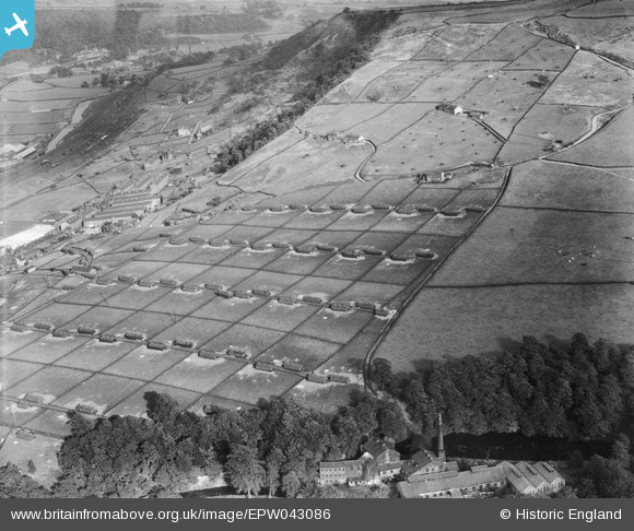
EPW043086 ENGLAND (1933). New House Poultry Farm, Mytholmroyd, 1933
© Copyright OpenStreetMap contributors and licensed by the OpenStreetMap Foundation. 2026. Cartography is licensed as CC BY-SA.
Nearby Images (4)
EPW043084

EPW043086

EPW043085

EPW043087

Details
| Title | [EPW043086] New House Poultry Farm, Mytholmroyd, 1933 |
| Reference | EPW043086 |
| Date | September-1933 |
| Link | |
| Place name | MYTHOLMROYD |
| Parish | HEBDEN ROYD |
| District | |
| Country | ENGLAND |
| Easting / Northing | 401100, 425400 |
| Longitude / Latitude | -1.9833269637001, 53.724778906214 |
| National Grid Reference | SE011254 |
Pins
Be the first to add a comment to this image!