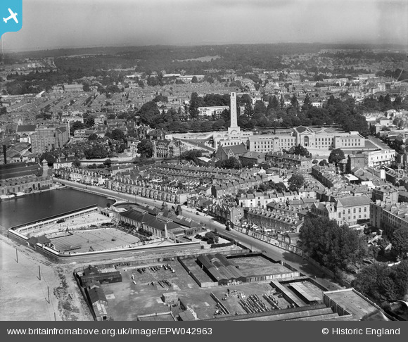
EPW042963 ENGLAND (1933). Western Esplanade, the Civic Centre and environs, Southampton, from the south-west, 1933
© Copyright OpenStreetMap contributors and licensed by the OpenStreetMap Foundation. 2026. Cartography is licensed as CC BY-SA.
Nearby Images (3)
EPW042963

EPW042955

EPW042961

Details
| Title | [EPW042963] Western Esplanade, the Civic Centre and environs, Southampton, from the south-west, 1933 |
| Reference | EPW042963 |
| Date | August-1933 |
| Link | |
| Place name | SOUTHAMPTON |
| Parish | |
| District | |
| Country | ENGLAND |
| Easting / Northing | 441731, 111881 |
| Longitude / Latitude | -1.4064442553563, 50.904339490942 |
| National Grid Reference | SU417119 |