
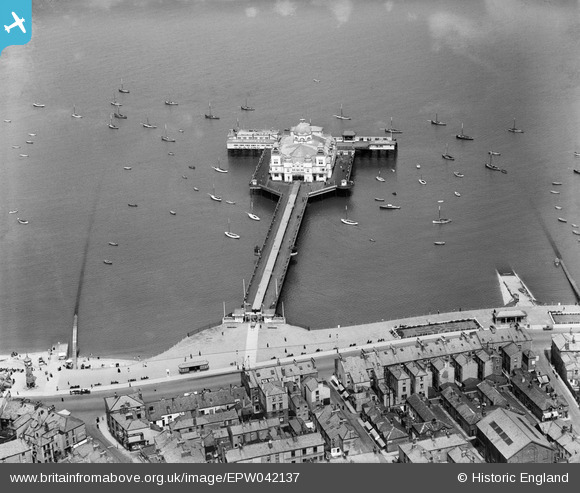
EPW042137 ENGLAND (1933). Central Pier, Morecambe, 1933
© Copyright OpenStreetMap contributors and licensed by the OpenStreetMap Foundation. 2026. Cartography is licensed as CC BY-SA.
Nearby Images (6)
EPW042137

EPW042129

EPW042128

EAW023411

EPW042132

EAW023410

Details
| Title | [EPW042137] Central Pier, Morecambe, 1933 |
| Reference | EPW042137 |
| Date | June-1933 |
| Link | |
| Place name | MORECAMBE |
| Parish | MORECAMBE |
| District | |
| Country | ENGLAND |
| Easting / Northing | 343408, 464712 |
| Longitude / Latitude | -2.8649969137158, 54.075040522604 |
| National Grid Reference | SD434647 |
