
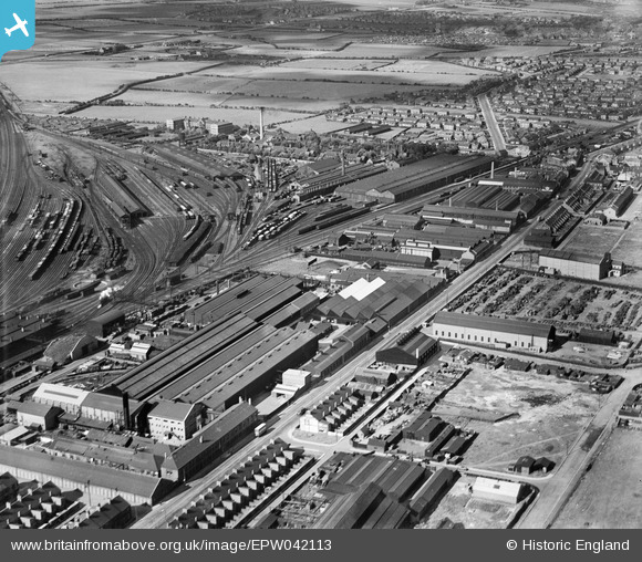
EPW042113 ENGLAND (1933). The C A Parsons and Co Heaton Works, Shields Road and environs, Heaton, 1933
© Copyright OpenStreetMap contributors and licensed by the OpenStreetMap Foundation. 2026. Cartography is licensed as CC BY-SA.
Nearby Images (19)
EPW042113

EAW005494

EPW042112

EAW005495

EAW005497

EPW059896

EPW054563

EAW005496

EPW059895

EAW005493

EAW006058

EAW006057

EAW022484

EAW022482

EAW006059

EAW006056

EPW042114

EPW042109

EAW005492

Details
| Title | [EPW042113] The C A Parsons and Co Heaton Works, Shields Road and environs, Heaton, 1933 |
| Reference | EPW042113 |
| Date | June-1933 |
| Link | |
| Place name | HEATON |
| Parish | |
| District | |
| Country | ENGLAND |
| Easting / Northing | 427880, 565556 |
| Longitude / Latitude | -1.5642932267514, 54.983747190241 |
| National Grid Reference | NZ279656 |
Pins
Be the first to add a comment to this image!