
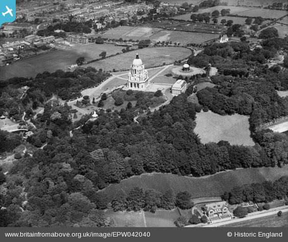
EPW042040 ENGLAND (1933). The Ashton Memorial and environs, Williamson Park, 1933
© Copyright OpenStreetMap contributors and licensed by the OpenStreetMap Foundation. 2026. Cartography is licensed as CC BY-SA.
Nearby Images (10)
EPW042040

EAW005628

EPW002085

EPW026403

EPW029181

EAW023409

EAW005627

EPW002082

EAW023408

EPW042039

Details
| Title | [EPW042040] The Ashton Memorial and environs, Williamson Park, 1933 |
| Reference | EPW042040 |
| Date | June-1933 |
| Link | |
| Place name | WILLIAMSON PARK |
| Parish | |
| District | |
| Country | ENGLAND |
| Easting / Northing | 348943, 461251 |
| Longitude / Latitude | -2.7798218090838, 54.044512272246 |
| National Grid Reference | SD489613 |
Pins
Be the first to add a comment to this image!