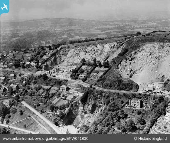
EPW041830 ENGLAND (1933). Upper Wyche Quarry, Upper Wyche, 1933
© Copyright OpenStreetMap contributors and licensed by the OpenStreetMap Foundation. 2026. Cartography is licensed as CC BY-SA.
Nearby Images (2)
EPW041830

 0°
0m
EPW041829
 160°
41m
Details
| Title | [EPW041830] Upper Wyche Quarry, Upper Wyche, 1933 |
| Reference | EPW041830 |
| Date | June-1933 |
| Link | |
| Place name | UPPER WYCHE |
| Parish | MALVERN WELLS |
| District | |
| Country | ENGLAND |
| Easting / Northing | 376991, 243988 |
| Longitude / Latitude | -2.3358929711007, 52.093343001133 |
| National Grid Reference | SO770440 |
 sentinel steam waggon