
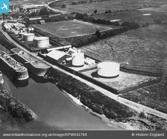
EPW041769 ENGLAND (1933). Fuel tanks next to Diglis Lock, Worcester, 1933. This image has been produced from a copy-negative.
© Copyright OpenStreetMap contributors and licensed by the OpenStreetMap Foundation. 2026. Cartography is licensed as CC BY-SA.
Nearby Images (10)
EPW041769

EPW035932

EPW035933

EPW035938

EPW035934

EPW035935

EPW035937

EPW035936

EPW041772

EPW035939

Details
| Title | [EPW041769] Fuel tanks next to Diglis Lock, Worcester, 1933. This image has been produced from a copy-negative. |
| Reference | EPW041769 |
| Date | June-1933 |
| Link | |
| Place name | WORCESTER |
| Parish | |
| District | |
| Country | ENGLAND |
| Easting / Northing | 384763, 253241 |
| Longitude / Latitude | -2.2228506845223, 52.176809685953 |
| National Grid Reference | SO848532 |
Pins
Be the first to add a comment to this image!