
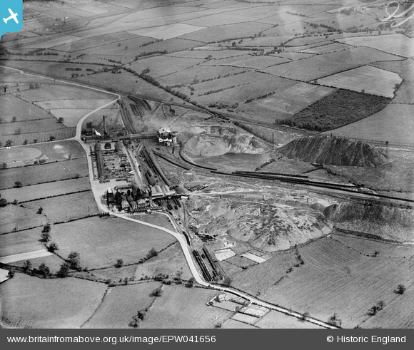
EPW041656 ENGLAND (1933). The Markham Colliery, Duckmanton, 1933
© Copyright OpenStreetMap contributors and licensed by the OpenStreetMap Foundation. 2026. Cartography is licensed as CC BY-SA.
Nearby Images (3)
EPW041656

EPW041655

EPW041654

Details
| Title | [EPW041656] The Markham Colliery, Duckmanton, 1933 |
| Reference | EPW041656 |
| Date | June-1933 |
| Link | |
| Place name | DUCKMANTON |
| Parish | STAVELEY |
| District | |
| Country | ENGLAND |
| Easting / Northing | 445085, 372168 |
| Longitude / Latitude | -1.3243063554467, 53.244337052801 |
| National Grid Reference | SK451722 |
Pins
Be the first to add a comment to this image!