
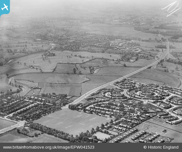
EPW041523 ENGLAND (1933). Princess Road and the Princess Parkway, Barlow Moor, from the north-west, 1933
© Copyright OpenStreetMap contributors and licensed by the OpenStreetMap Foundation. 2026. Cartography is licensed as CC BY-SA.
Nearby Images (4)
EPW041523

EPW017423

EPW041522

EPW041524

Details
| Title | [EPW041523] Princess Road and the Princess Parkway, Barlow Moor, from the north-west, 1933 |
| Reference | EPW041523 |
| Date | June-1933 |
| Link | |
| Place name | BARLOW MOOR |
| Parish | |
| District | |
| Country | ENGLAND |
| Easting / Northing | 382911, 391757 |
| Longitude / Latitude | -2.2571800602895, 53.422074462226 |
| National Grid Reference | SJ829918 |
