
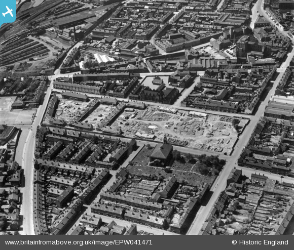
EPW041471 ENGLAND (1933). New housing under construction on the site of the Barracks, Birmingham, 1933. This image has been produced from a print.
© Copyright OpenStreetMap contributors and licensed by the OpenStreetMap Foundation. 2026. Cartography is licensed as CC BY-SA.
Nearby Images (2)
EPW041471

EPW038604

Details
| Title | [EPW041471] New housing under construction on the site of the Barracks, Birmingham, 1933. This image has been produced from a print. |
| Reference | EPW041471 |
| Date | June-1933 |
| Link | |
| Place name | BIRMINGHAM |
| Parish | |
| District | |
| Country | ENGLAND |
| Easting / Northing | 408273, 287483 |
| Longitude / Latitude | -1.8781588391395, 52.48483527823 |
| National Grid Reference | SP083875 |
Pins

cabbagecaff |
Sunday 30th of March 2025 06:06:52 PM |