
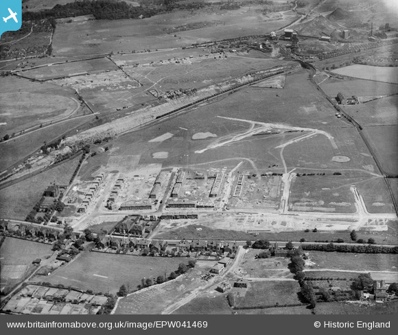
EPW041469 ENGLAND (1933). New housing under construction along Hall Road, Handsworth, 1933
© Copyright OpenStreetMap contributors and licensed by the OpenStreetMap Foundation. 2026. Cartography is licensed as CC BY-SA.
Nearby Images (6)
EPW041469

EPW041464

EPW041465

EPW041463

EPW041467

EPW041470

Details
| Title | [EPW041469] New housing under construction along Hall Road, Handsworth, 1933 |
| Reference | EPW041469 |
| Date | June-1933 |
| Link | |
| Place name | HANDSWORTH |
| Parish | |
| District | |
| Country | ENGLAND |
| Easting / Northing | 440233, 387352 |
| Longitude / Latitude | -1.3950925242441, 53.381219686434 |
| National Grid Reference | SK402874 |
Pins

Railway Man |
Thursday 26th of September 2019 07:43:19 PM | |
|
ambergirls |
Wednesday 13th of November 2013 01:34:02 PM |