
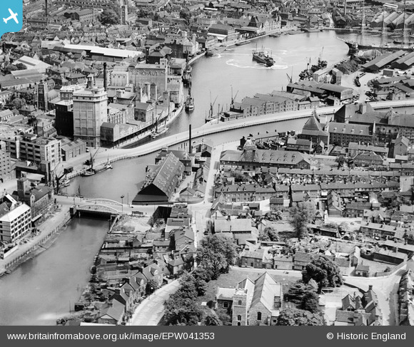
EPW041353 ENGLAND (1933). The New Cut at Stoke Bridge and environs, Ipswich, 1933
© Copyright OpenStreetMap contributors and licensed by the OpenStreetMap Foundation. 2026. Cartography is licensed as CC BY-SA.
Nearby Images (8)
EPW041353

EPW041350

EPW041352

EPW041351

EAW053511

EPW058746

EPW058747

EPW049173

Details
| Title | [EPW041353] The New Cut at Stoke Bridge and environs, Ipswich, 1933 |
| Reference | EPW041353 |
| Date | May-1933 |
| Link | |
| Place name | IPSWICH |
| Parish | |
| District | |
| Country | ENGLAND |
| Easting / Northing | 616421, 243919 |
| Longitude / Latitude | 1.1567754286828, 52.050909284669 |
| National Grid Reference | TM164439 |
Pins
Be the first to add a comment to this image!