
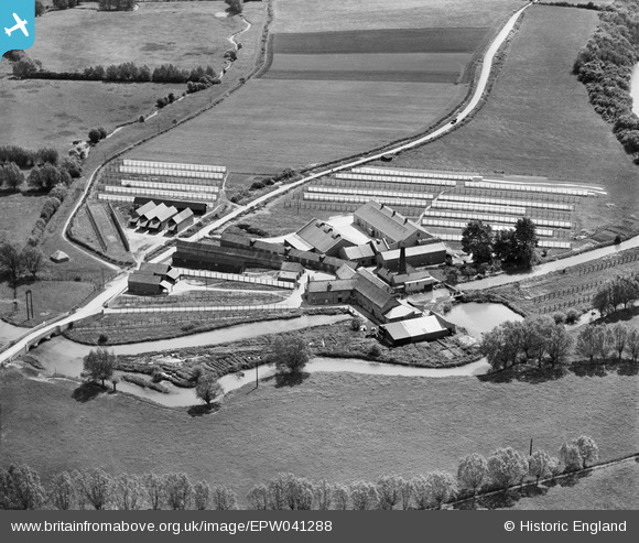
EPW041288 ENGLAND (1933). Crawley Blanket Mill, Crawley, 1933
© Copyright OpenStreetMap contributors and licensed by the OpenStreetMap Foundation. 2025. Cartography is licensed as CC BY-SA.
Nearby Images (7)
EPW041288

EPW041286

EPW041289

EPW041285

EPW041284

EPW041290

EPW041287

Details
| Title | [EPW041288] Crawley Blanket Mill, Crawley, 1933 |
| Reference | EPW041288 |
| Date | May-1933 |
| Link | |
| Place name | CRAWLEY |
| Parish | CRAWLEY |
| District | |
| Country | ENGLAND |
| Easting / Northing | 433881, 211710 |
| Longitude / Latitude | -1.5085817154336, 51.802556775252 |
| National Grid Reference | SP339117 |
Pins
Be the first to add a comment to this image!