
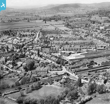
EPW041226 ENGLAND (1933). Bulmer's Cider Works, Ryelands and environs, Hereford, from the south-east, 1933

© Copyright OpenStreetMap contributors and licensed by the OpenStreetMap Foundation. 2026. Cartography is licensed as CC BY-SA.
Details
| Title | [EPW041226] Bulmer's Cider Works, Ryelands and environs, Hereford, from the south-east, 1933 |
| Reference | EPW041226 |
| Date | May-1933 |
| Link | |
| Place name | HEREFORD |
| Parish | HEREFORD |
| District | |
| Country | ENGLAND |
| Easting / Northing | 350328, 239638 |
| Longitude / Latitude | -2.7244702431478, 52.052481156199 |
| National Grid Reference | SO503396 |
Pins

Allan |
Monday 2nd of March 2020 10:47:33 PM | |
|
Dr. David Woods |
Friday 5th of February 2016 03:27:40 PM | |
|
Dr. David Woods |
Friday 5th of February 2016 03:24:58 PM | |
|
Dr. David Woods |
Friday 5th of February 2016 03:22:51 PM | |
|
Dr. David Woods |
Friday 5th of February 2016 03:20:37 PM | |
|
Dr. David Woods |
Friday 5th of February 2016 03:16:35 PM |
User Comment Contributions
Bulmer's Cider Works, Ryelands and environs, Hereford, from the south-east, 1933 |
Hollybush |
Saturday 4th of May 2013 04:33:06 PM |