
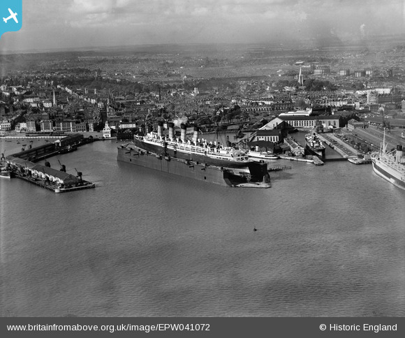
EPW041072 ENGLAND (1933). The RMS Mauretania in the floating dry dock, Southampton, from the south, 1933
© Copyright OpenStreetMap contributors and licensed by the OpenStreetMap Foundation. 2026. Cartography is licensed as CC BY-SA.
Nearby Images (17)
EPW041072

EAW008810

EPW020445

EPW000238

EAW001355

EAW001361

EAW015268

EPW037430

EPW041073

EPW041070

EPW041039
 formation flying over Kingswood, Sanderstead, from the east, 1933")
EPW041069

EPW020452

EAW001358

EAW033413

EPW009070

EPW020455

Details
| Title | [EPW041072] The RMS Mauretania in the floating dry dock, Southampton, from the south, 1933 |
| Reference | EPW041072 |
| Date | April-1933 |
| Link | |
| Place name | SOUTHAMPTON |
| Parish | |
| District | |
| Country | ENGLAND |
| Easting / Northing | 442030, 110354 |
| Longitude / Latitude | -1.4023675109079, 50.89058556697 |
| National Grid Reference | SU420104 |
Pins
Be the first to add a comment to this image!