
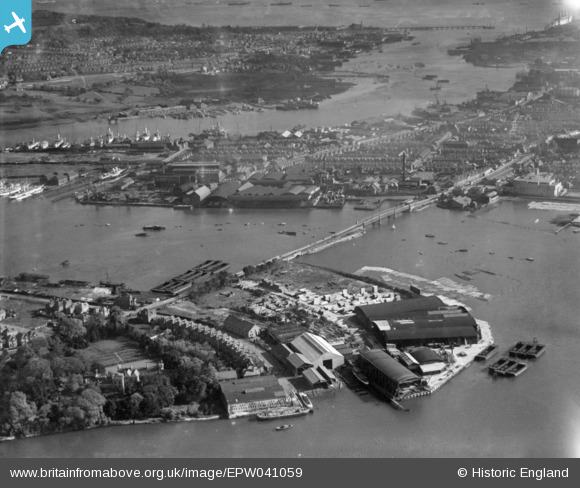
EPW041059 ENGLAND (1933). Northam Bridge and the River Itchen, Southampton, from the north-west, 1933. This image has been produced from a print.
© Copyright OpenStreetMap contributors and licensed by the OpenStreetMap Foundation. 2026. Cartography is licensed as CC BY-SA.
Nearby Images (14)
EPW041059

EAW035241

EAW035240

EAW035234

EAW035238

EAW035231

EAW035239

EAW035229

EAW035233

EAW035236

EAW035232

EAW035230

EAW035235

EAW035237

Details
| Title | [EPW041059] Northam Bridge and the River Itchen, Southampton, from the north-west, 1933. This image has been produced from a print. |
| Reference | EPW041059 |
| Date | April-1933 |
| Link | |
| Place name | SOUTHAMPTON |
| Parish | |
| District | |
| Country | ENGLAND |
| Easting / Northing | 443278, 113288 |
| Longitude / Latitude | -1.384275106504, 50.916878564906 |
| National Grid Reference | SU433133 |
Pins
Be the first to add a comment to this image!