
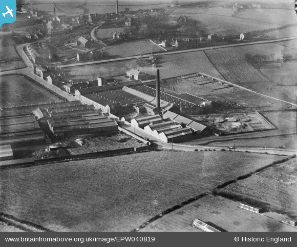
EPW040819 ENGLAND (1933). The British Belting & Asbestos Ltd Scandinavia Belting Mill, Cleckheaton, 1933
© Copyright OpenStreetMap contributors and licensed by the OpenStreetMap Foundation. 2026. Cartography is licensed as CC BY-SA.
Nearby Images (19)
EPW040819

EPW040821

EPW040823

EPW040822

EAW002669

EAW002668

EAW002666

EPW040820

EPW040826

EPW040824

EAW002670

EAW002667

EPW048012
 and Recreation Ground, Cleckheaton, 1935")
EPW048010
 and Recreation Ground, Cleckheaton, 1935")
EPW048011
 and Recreation Ground, Cleckheaton, 1935")
EPW048006
 and Recreation Ground, Cleckheaton, 1935")
EPW048007
 and Recreation Ground, Cleckheaton, 1935")
EPW048008
 and Recreation Ground, Cleckheaton, 1935")
EPW048009
, Cleckheaton, 1935")
Details
| Title | [EPW040819] The British Belting & Asbestos Ltd Scandinavia Belting Mill, Cleckheaton, 1933 |
| Reference | EPW040819 |
| Date | February-1933 |
| Link | |
| Place name | CLECKHEATON |
| Parish | |
| District | |
| Country | ENGLAND |
| Easting / Northing | 418706, 426373 |
| Longitude / Latitude | -1.7164104916987, 53.733190956972 |
| National Grid Reference | SE187264 |
Pins
Be the first to add a comment to this image!