
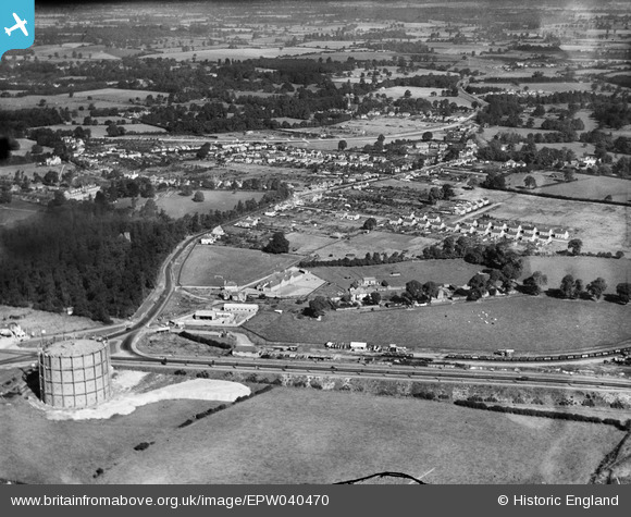
EPW040470 ENGLAND (1932). Lea Farm, St Alban's Road and environs, Garston, 1932
© Copyright OpenStreetMap contributors and licensed by the OpenStreetMap Foundation. 2025. Cartography is licensed as CC BY-SA.
Nearby Images (2)
EPW040470

EPW040471

Details
| Title | [EPW040470] Lea Farm, St Alban's Road and environs, Garston, 1932 |
| Reference | EPW040470 |
| Date | September-1932 |
| Link | |
| Place name | GARSTON |
| Parish | |
| District | |
| Country | ENGLAND |
| Easting / Northing | 511403, 199628 |
| Longitude / Latitude | -0.38836719626107, 51.683885231274 |
| National Grid Reference | TQ114996 |
Pins

John W |
Friday 22nd of July 2016 09:01:01 PM | |
|
John W |
Friday 22nd of July 2016 08:59:30 PM | |
|
John W |
Friday 22nd of July 2016 08:58:03 PM | |
|
John W |
Friday 22nd of July 2016 08:57:11 PM | |
|
John W |
Friday 22nd of July 2016 08:56:45 PM |