
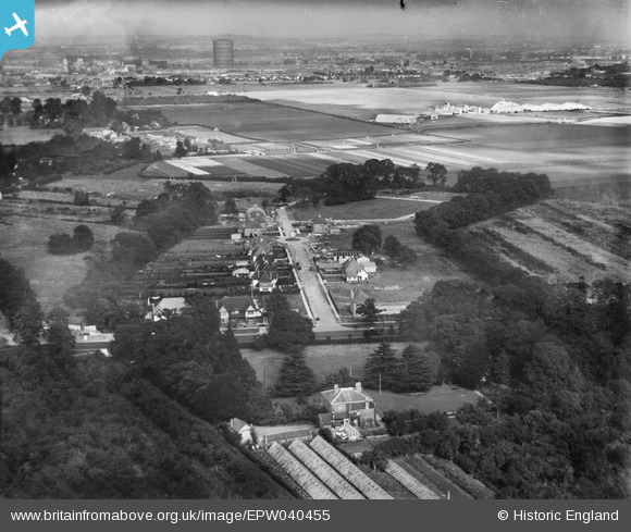
EPW040455 ENGLAND (1932). Laing's Cranford Estate at Firs Drive, Heston Aerodrome and environs, Cranford, from the south-west, 1932
© Copyright OpenStreetMap contributors and licensed by the OpenStreetMap Foundation. 2026. Cartography is licensed as CC BY-SA.
Nearby Images (7)
EPW040455

EPW040456

EPW040461

EPW056594

EPW040458

EPW040459

EPW040457

Details
| Title | [EPW040455] Laing's Cranford Estate at Firs Drive, Heston Aerodrome and environs, Cranford, from the south-west, 1932 |
| Reference | EPW040455 |
| Date | September-1932 |
| Link | |
| Place name | CRANFORD |
| Parish | |
| District | |
| Country | ENGLAND |
| Easting / Northing | 510561, 176747 |
| Longitude / Latitude | -0.40774909211401, 51.478376861194 |
| National Grid Reference | TQ106767 |
Pins

Martin Devlin |
Monday 4th of October 2021 11:45:36 AM | |
|
Martin Devlin |
Monday 4th of October 2021 11:43:09 AM |