
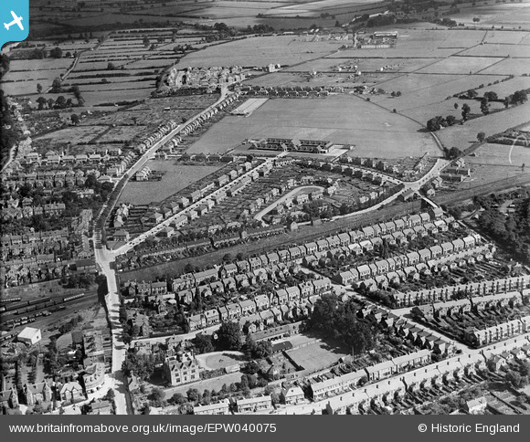
EPW040075 ENGLAND (1932). Residential development adjacent to the railway line at Cherry Orchard, Shrewsbury, 1932
© Copyright OpenStreetMap contributors and licensed by the OpenStreetMap Foundation. 2026. Cartography is licensed as CC BY-SA.
Nearby Images (2)
EPW040075

EAW017471

Details
| Title | [EPW040075] Residential development adjacent to the railway line at Cherry Orchard, Shrewsbury, 1932 |
| Reference | EPW040075 |
| Date | August-1932 |
| Link | |
| Place name | SHREWSBURY |
| Parish | SHREWSBURY |
| District | |
| Country | ENGLAND |
| Easting / Northing | 350486, 312764 |
| Longitude / Latitude | -2.73297295696, 52.709929696251 |
| National Grid Reference | SJ505128 |
Pins

Norrie P |
Friday 27th of June 2014 06:44:41 PM | |
Hangar constructed with Belfast roof trusses. In 2016 planning permission was applied for to demolish and build houses but was rejected, in 2017 this was appealed but was also rejected. We need to save our historic buildings |
Kev |
Wednesday 29th of March 2017 10:07:11 AM |