
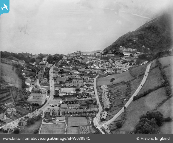
EPW039941 ENGLAND (1932). Lydia Lane, Lee Road and the town, Lynton, from the south-west, 1932
© Copyright OpenStreetMap contributors and licensed by the OpenStreetMap Foundation. 2026. Cartography is licensed as CC BY-SA.
Nearby Images (4)
EPW039941

EPW033314

EPW033312

EPW033315

Details
| Title | [EPW039941] Lydia Lane, Lee Road and the town, Lynton, from the south-west, 1932 |
| Reference | EPW039941 |
| Date | August-1932 |
| Link | |
| Place name | LYNTON |
| Parish | LYNTON AND LYNMOUTH |
| District | |
| Country | ENGLAND |
| Easting / Northing | 271694, 149302 |
| Longitude / Latitude | -3.837775175392, 51.227951909408 |
| National Grid Reference | SS717493 |
Pins
Be the first to add a comment to this image!