
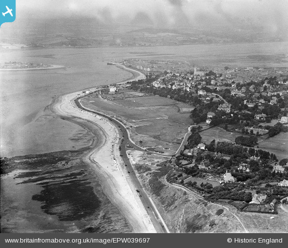
EPW039697 ENGLAND (1932). The Maer and environs, Exmouth, from the south-east, 1932
© Copyright OpenStreetMap contributors and licensed by the OpenStreetMap Foundation. 2026. Cartography is licensed as CC BY-SA.
Nearby Images (2)
EPW039697

EPW033468

Details
| Title | [EPW039697] The Maer and environs, Exmouth, from the south-east, 1932 |
| Reference | EPW039697 |
| Date | August-1932 |
| Link | |
| Place name | EXMOUTH |
| Parish | EXMOUTH |
| District | |
| Country | ENGLAND |
| Easting / Northing | 301188, 79986 |
| Longitude / Latitude | -3.396692601163, 50.610623769281 |
| National Grid Reference | SY012800 |
Pins
Be the first to add a comment to this image!