
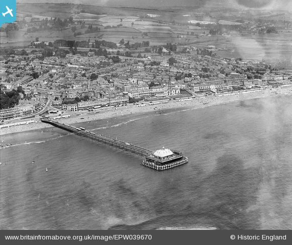
EPW039670 ENGLAND (1932). The Pier and the town, Sandown, 1932
© Copyright OpenStreetMap contributors and licensed by the OpenStreetMap Foundation. 2026. Cartography is licensed as CC BY-SA.
Nearby Images (18)
EPW039670

EPW039672

EPW023081

EPW023080

EAW038582

EAW022219

EAW022215

EPW023085

EPW023083

EPW043028

EAW038580

EPW023084

EAW038583

EAW022218

EPW043023

EPW039671

EPW043029

EAW038581

Details
| Title | [EPW039670] The Pier and the town, Sandown, 1932 |
| Reference | EPW039670 |
| Date | 12-August-1932 |
| Link | |
| Place name | SANDOWN |
| Parish | SANDOWN |
| District | |
| Country | ENGLAND |
| Easting / Northing | 459958, 84066 |
| Longitude / Latitude | -1.1517578968324, 50.652603872918 |
| National Grid Reference | SZ600841 |
Pins
Be the first to add a comment to this image!