
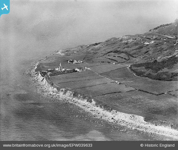
EPW039633 ENGLAND (1932). St Catherine's Lighthouse and the coastline, St Catherine's Point, from the south-east, 1932
© Copyright OpenStreetMap contributors and licensed by the OpenStreetMap Foundation. 2026. Cartography is licensed as CC BY-SA.
Nearby Images (2)
EPW039633

EPW023087

Details
| Title | [EPW039633] St Catherine's Lighthouse and the coastline, St Catherine's Point, from the south-east, 1932 |
| Reference | EPW039633 |
| Date | 12-August-1932 |
| Link | |
| Place name | ST CATHERINE'S POINT |
| Parish | NITON AND WHITWELL |
| District | |
| Country | ENGLAND |
| Easting / Northing | 450138, 75303 |
| Longitude / Latitude | -1.2918558732629, 50.574724920425 |
| National Grid Reference | SZ501753 |
Pins

SteveB |
Saturday 24th of October 2020 11:03:47 PM |
