
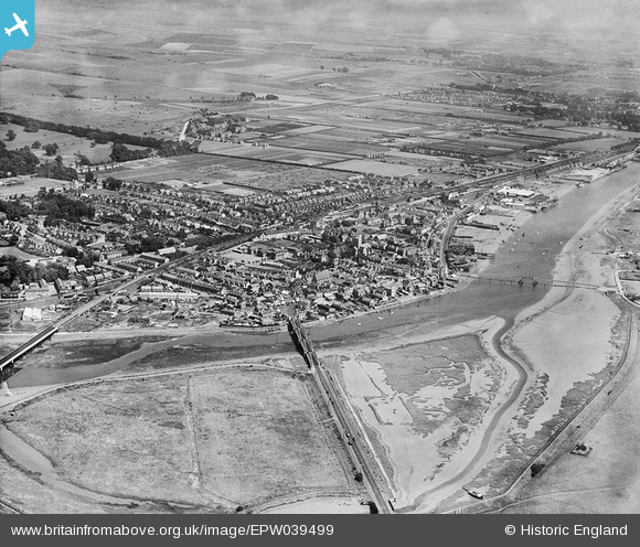
EPW039499 ENGLAND (1932). Norfolk Bridge, the River Adur and the town, Shoreham-by-Sea, 1932
© Copyright OpenStreetMap contributors and licensed by the OpenStreetMap Foundation. 2026. Cartography is licensed as CC BY-SA.
Nearby Images (4)
EPW039499

EPW018085

EPW054144

EPW039497

Details
| Title | [EPW039499] Norfolk Bridge, the River Adur and the town, Shoreham-by-Sea, 1932 |
| Reference | EPW039499 |
| Date | August-1932 |
| Link | |
| Place name | SHOREHAM-BY-SEA |
| Parish | |
| District | |
| Country | ENGLAND |
| Easting / Northing | 521566, 105165 |
| Longitude / Latitude | -0.27352373397944, 50.832675419059 |
| National Grid Reference | TQ216052 |
Pins

Alan McFaden |
Monday 2nd of December 2013 08:33:09 PM | |
|
Alan McFaden |
Monday 2nd of December 2013 08:08:10 PM | |

MB |
Monday 2nd of December 2013 12:36:36 PM | |
|
MB |
Monday 2nd of December 2013 12:36:10 PM | |
|
MB |
Monday 2nd of December 2013 12:35:26 PM | |
|
Alan McFaden |
Saturday 16th of November 2013 06:27:31 PM | |
|
Alan McFaden |
Saturday 16th of November 2013 06:26:23 PM | |
|
Alan McFaden |
Saturday 16th of November 2013 06:25:36 PM |


