
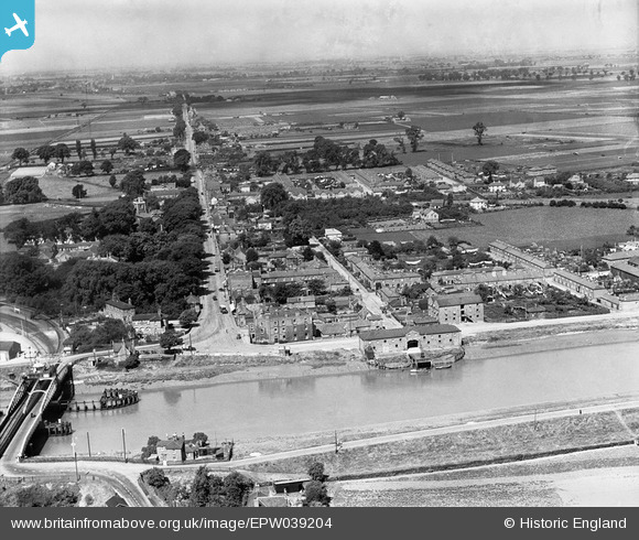
EPW039204 ENGLAND (1932). Bridge Road and environs, Sutton Bridge, from the south-east, 1932
© Copyright OpenStreetMap contributors and licensed by the OpenStreetMap Foundation. 2026. Cartography is licensed as CC BY-SA.
Nearby Images (2)
EPW039204

EPW039205

Details
| Title | [EPW039204] Bridge Road and environs, Sutton Bridge, from the south-east, 1932 |
| Reference | EPW039204 |
| Date | July-1932 |
| Link | |
| Place name | SUTTON BRIDGE |
| Parish | SUTTON BRIDGE |
| District | |
| Country | ENGLAND |
| Easting / Northing | 548253, 321127 |
| Longitude / Latitude | 0.19763849598738, 52.767027193677 |
| National Grid Reference | TF483211 |
Pins

geeegs |
Sunday 2nd of February 2025 08:48:29 PM | |
|
pf329 |
Saturday 11th of July 2015 05:33:37 PM | |
|
pf329 |
Saturday 11th of July 2015 05:29:20 PM | |
|
pf329 |
Saturday 11th of July 2015 05:26:36 PM | |
|
pf329 |
Saturday 11th of July 2015 05:18:52 PM | |
|
pf329 |
Saturday 11th of July 2015 05:18:11 PM | |
|
pf329 |
Saturday 11th of July 2015 04:41:14 PM | |
|
Peter |
Friday 21st of February 2014 09:25:15 PM |