
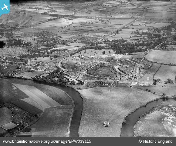
EPW039115 ENGLAND (1932). The Portobello housing estate and environs, Portobello, 1932
© Copyright OpenStreetMap contributors and licensed by the OpenStreetMap Foundation. 2026. Cartography is licensed as CC BY-SA.
Nearby Images (8)
EPW039115

EPW039117

EPW039116

EPW017204

EPW017207

EPW017205

EPW017206

EPW061503

Details
| Title | [EPW039115] The Portobello housing estate and environs, Portobello, 1932 |
| Reference | EPW039115 |
| Date | July-1932 |
| Link | |
| Place name | PORTOBELLO |
| Parish | |
| District | |
| Country | ENGLAND |
| Easting / Northing | 433626, 418840 |
| Longitude / Latitude | -1.4910432779675, 53.664729619119 |
| National Grid Reference | SE336188 |
Pins
Be the first to add a comment to this image!