
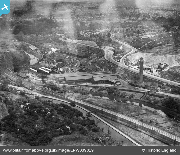
EPW039019 ENGLAND (1932). Kirkstall Iron and Steel Forge and environs, Kirkstall, 1932
© Copyright OpenStreetMap contributors and licensed by the OpenStreetMap Foundation. 2026. Cartography is licensed as CC BY-SA.
Nearby Images (11)
EPW039019

EPW039021

EPW039020

EPW039022

EPW039023

EAW002621

EAW002629

EPW039024

EAW002622

EAW002623

EAW002627

Details
| Title | [EPW039019] Kirkstall Iron and Steel Forge and environs, Kirkstall, 1932 |
| Reference | EPW039019 |
| Date | July-1932 |
| Link | |
| Place name | KIRKSTALL |
| Parish | |
| District | |
| Country | ENGLAND |
| Easting / Northing | 425048, 436540 |
| Longitude / Latitude | -1.619439676724, 53.824314466679 |
| National Grid Reference | SE250365 |
Pins

Mikeya |
Tuesday 30th of June 2020 05:32:01 PM |