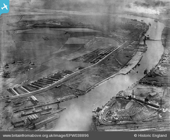
EPW038896 ENGLAND (1932). Port Clarence Road, the Tees Transporter Bridge and environs, Port Clarence, from the west, 1932
    © Copyright OpenStreetMap contributors and licensed by the OpenStreetMap Foundation. 2025. Cartography is licensed as CC BY-SA.
  
Details
| Title | [EPW038896] Port Clarence Road, the Tees Transporter Bridge and environs, Port Clarence, from the west, 1932 | 
| Reference | EPW038896 | 
| Date | July-1932 | 
| Link | |
| Place name | PORT CLARENCE | 
| Parish | BILLINGHAM | 
| District | |
| Country | ENGLAND | 
| Easting / Northing | 449175, 521920 | 
| Longitude / Latitude | -1.2389227380485, 54.589954929229 | 
| National Grid Reference | NZ492219 | 
Pins
Be the first to add a comment to this image!
 
             
  ![[EPW038896] Port Clarence Road, the Tees Transporter Bridge and environs, Port Clarence, from the west, 1932](http://britainfromabove.org.uk/sites/all/libraries/aerofilms-images/public/100x100/EPW/038/EPW038896.jpg) 
  
                                          ![[EAW030443] The Furness Shipbuilding Yard with H.M. Wrangell and the London Pride docked in the basin, Billingham, from the east, 1950. This image was marked by Aerofilms Ltd for photo editing.](http://britainfromabove.org.uk/sites/all/libraries/aerofilms-images/public/100x100/EAW/030/EAW030443.jpg) 
 ![[EAW030439] The Furness Shipbuilding Yard with H.M. Wrangell and the London Pride docked in the basin, Billingham, from the east, 1950. This image was marked by Aerofilms Ltd for photo editing.](http://britainfromabove.org.uk/sites/all/libraries/aerofilms-images/public/100x100/EAW/030/EAW030439.jpg)