
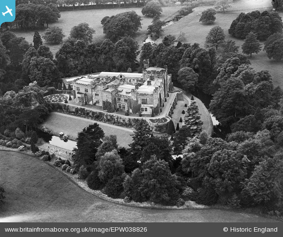
EPW038826 ENGLAND (1932). Thurland Castle, Cantsfield, 1932
© Copyright OpenStreetMap contributors and licensed by the OpenStreetMap Foundation. 2026. Cartography is licensed as CC BY-SA.
Nearby Images (3)
EPW038826

EPW038824

EPW038825

Details
| Title | [EPW038826] Thurland Castle, Cantsfield, 1932 |
| Reference | EPW038826 |
| Date | July-1932 |
| Link | |
| Place name | CANTSFIELD |
| Parish | CANTSFIELD |
| District | |
| Country | ENGLAND |
| Easting / Northing | 361096, 473079 |
| Longitude / Latitude | -2.5957365950438, 54.151883521065 |
| National Grid Reference | SD611731 |
Pins

totoro |
Saturday 8th of February 2014 05:48:47 PM | |
|
totoro |
Saturday 8th of February 2014 05:43:50 PM | |
|
totoro |
Saturday 8th of February 2014 05:42:55 PM | |
|
totoro |
Saturday 8th of February 2014 05:39:24 PM |
User Comment Contributions
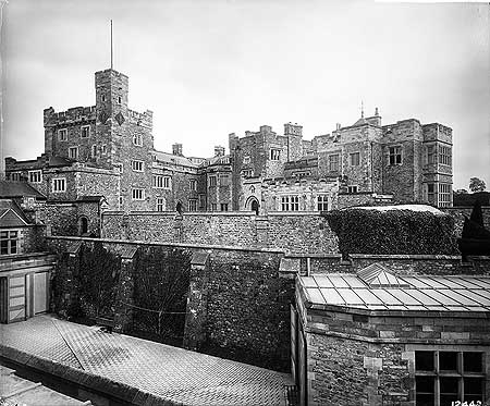
Image: The main house at Thurland Castle, as seen from the roof of the stables. 20 Oct 1893 Image from http://www.englishheritagearchives.org.uk/SingleResult/ Default.aspx?id=990162&t=Quick&l=all&cr=thurland+castle&io=True Not to be reproduced without permission; Reproduced by permission of English Heritage. Photographer: Henry Bedford Lemere, Bedford Lemere and Company. There are many images of the interior and exterior of the castle at http://www.englishheritagearchives.org.uk/results/results.aspx? t=Quick&l=all&cr=thurland%20castle&io=True |
totoro |
Saturday 8th of February 2014 06:21:16 PM |