
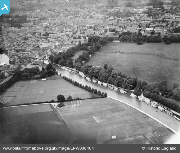
EPW038404 ENGLAND (1932). The River Thames, Christchurch Meadow and the city, Oxford, 1932
© Copyright OpenStreetMap contributors and licensed by the OpenStreetMap Foundation. 2026. Cartography is licensed as CC BY-SA.
Nearby Images (10)
EPW038404

EPW000820

EPW000836

EAW003602

EPW000824

EPW038405

EPW048875

EAW047926

EAW003126

EAW014894

Details
| Title | [EPW038404] The River Thames, Christchurch Meadow and the city, Oxford, 1932 |
| Reference | EPW038404 |
| Date | June-1932 |
| Link | |
| Place name | OXFORD |
| Parish | |
| District | |
| Country | ENGLAND |
| Easting / Northing | 451637, 205447 |
| Longitude / Latitude | -1.2519955905488, 51.744886000497 |
| National Grid Reference | SP516054 |
Pins

Antonia Harland-Lang |
Thursday 7th of March 2013 03:26:26 PM | |
It used to be the Salter Brothers boatyard building - English Heritage have a good photo of it at http://www.heritage-explorer.co.uk/web/he/searchdetail.aspx?id=4134&crit=yard. It became the Head of the River pub some time in the 1970s I believe. |

Mattle |
Tuesday 13th of May 2014 12:37:37 PM |