
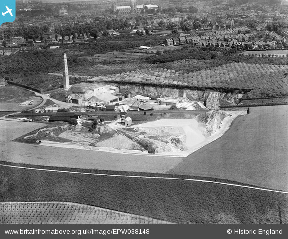
EPW038148 ENGLAND (1932). The Cooper Frank Lime Works, Canterbury, 1932
© Copyright OpenStreetMap contributors and licensed by the OpenStreetMap Foundation. 2025. Cartography is licensed as CC BY-SA.
Nearby Images (2)
EPW038148

EPW038147

Details
| Title | [EPW038148] The Cooper Frank Lime Works, Canterbury, 1932 |
| Reference | EPW038148 |
| Date | May-1932 |
| Link | |
| Place name | CANTERBURY |
| Parish | |
| District | |
| Country | ENGLAND |
| Easting / Northing | 614776, 156678 |
| Longitude / Latitude | 1.0792120860881, 51.268208692767 |
| National Grid Reference | TR148567 |
Pins

Mike |
Monday 24th of July 2023 11:55:10 PM | |
|
Andyreno205 |
Wednesday 19th of January 2022 11:28:39 AM | |
|
Andyreno205 |
Wednesday 19th of January 2022 11:25:23 AM | |
|
Andyreno205 |
Wednesday 19th of January 2022 11:22:16 AM |