
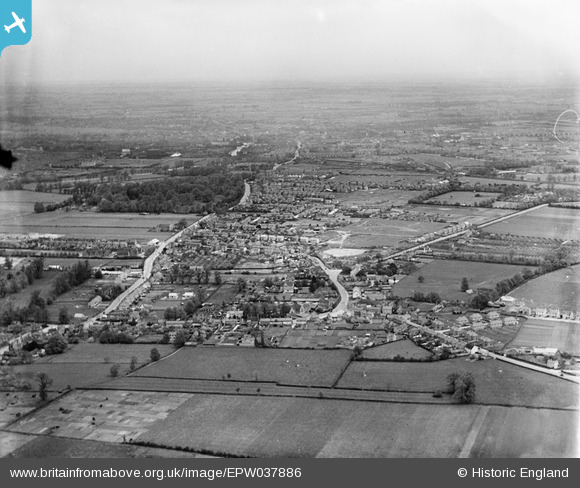
EPW037886 ENGLAND (1932). The town and surrounding countryside, Kempston, from the south-west, 1932
© Copyright OpenStreetMap contributors and licensed by the OpenStreetMap Foundation. 2026. Cartography is licensed as CC BY-SA.
Nearby Images (3)
EPW037886

EPW037887

EPW037888

Details
| Title | [EPW037886] The town and surrounding countryside, Kempston, from the south-west, 1932 |
| Reference | EPW037886 |
| Date | May-1932 |
| Link | |
| Place name | KEMPSTON |
| Parish | KEMPSTON |
| District | |
| Country | ENGLAND |
| Easting / Northing | 502936, 247273 |
| Longitude / Latitude | -0.49657933797797, 52.113774107092 |
| National Grid Reference | TL029473 |
Pins
 |

melgibbs |
Saturday 28th of March 2015 11:29:32 AM |
|
melgibbs |
Friday 27th of March 2015 10:38:59 AM | |
|
melgibbs |
Friday 27th of March 2015 07:39:11 AM | |
|
melgibbs |
Wednesday 25th of March 2015 04:35:21 PM | |
|
melgibbs |
Wednesday 25th of March 2015 04:34:55 PM | |
|
melgibbs |
Wednesday 25th of March 2015 04:26:29 PM | |
|
melgibbs |
Thursday 24th of April 2014 08:21:08 PM | |
|
melgibbs |
Tuesday 24th of December 2013 09:44:12 PM | |
|
melgibbs |
Tuesday 24th of December 2013 09:40:43 PM | |
 |
melgibbs |
Tuesday 24th of December 2013 09:27:10 PM |
|
melgibbs |
Tuesday 11th of June 2013 01:27:01 PM |
User Comment Contributions
See also similar images EPW037887 & EPW037888. |
melgibbs |
Wednesday 12th of June 2013 07:07:05 PM |