
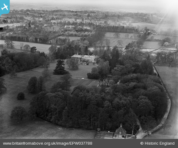
EPW037788 ENGLAND (1932). Garston Manor and environs, Abbots Langley, from the south-east, 1932
© Copyright OpenStreetMap contributors and licensed by the OpenStreetMap Foundation. 2026. Cartography is licensed as CC BY-SA.
Nearby Images (3)
EPW037788

EPW037550

EPW037787

Details
| Title | [EPW037788] Garston Manor and environs, Abbots Langley, from the south-east, 1932 |
| Reference | EPW037788 |
| Date | May-1932 |
| Link | |
| Place name | ABBOTS LANGLEY |
| Parish | ABBOTS LANGLEY |
| District | |
| Country | ENGLAND |
| Easting / Northing | 511174, 201582 |
| Longitude / Latitude | -0.39105586609567, 51.701494473763 |
| National Grid Reference | TL112016 |
Pins
Be the first to add a comment to this image!