
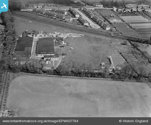
EPW037784 ENGLAND (1932). The Oldfield Works, Hampton, 1932
© Copyright OpenStreetMap contributors and licensed by the OpenStreetMap Foundation. 2026. Cartography is licensed as CC BY-SA.
Nearby Images (24)
EPW037784

EPW053644

EPW045248

EPW053647

EPW045641

EPW045249

EPW045247

EPW045251

EPW045638

EPW045640

EPW045250

EPW041098
, Hampton, 1933")
EPW053645

EPW053643

EPW037782

EPW053648

EPW037783

EPW053646

EPW022860

EPW045639

EPW041097
, Hampton, 1933")
EPW041096
 and Metropolitan Water Board Water Works, Hampton, 1933")
EPW041099
 and Metropolitan Water Board Water Works, Hampton, 1933")
EPW041095
 and Metropolitan Water Board Water Works, Hampton, 1933")
Details
| Title | [EPW037784] The Oldfield Works, Hampton, 1932 |
| Reference | EPW037784 |
| Date | May-1932 |
| Link | |
| Place name | HAMPTON |
| Parish | |
| District | |
| Country | ENGLAND |
| Easting / Northing | 512733, 169770 |
| Longitude / Latitude | -0.37870540905631, 51.415231968191 |
| National Grid Reference | TQ127698 |
Pins
Be the first to add a comment to this image!