
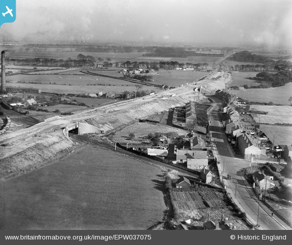
EPW037075 ENGLAND (1931). The East Lancashire Road (A580) under construction, Haydock, from the west, 1931
© Copyright OpenStreetMap contributors and licensed by the OpenStreetMap Foundation. 2026. Cartography is licensed as CC BY-SA.
Nearby Images (3)
EPW037075
 under construction, Haydock, from the west, 1931")
EPW037074
 under construction, Haydock, from the west, 1931")
EPW037082
 under construction, Haydock, from the west, 1931")
Details
| Title | [EPW037075] The East Lancashire Road (A580) under construction, Haydock, from the west, 1931 |
| Reference | EPW037075 |
| Date | October-1931 |
| Link | |
| Place name | HAYDOCK |
| Parish | |
| District | |
| Country | ENGLAND |
| Easting / Northing | 357056, 397399 |
| Longitude / Latitude | -2.6470348327629, 53.471318708109 |
| National Grid Reference | SJ571974 |
Pins

adamw66 |
Thursday 5th of January 2017 04:18:59 PM |