
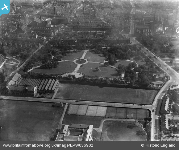
EPW036902 ENGLAND (1931). The People's Park, Halifax, 1931
© Copyright OpenStreetMap contributors and licensed by the OpenStreetMap Foundation. 2026. Cartography is licensed as CC BY-SA.
Nearby Images (5)
EPW036902

EPW036900

EPW036899

EPW013880

EPW013882

Details
| Title | [EPW036902] The People's Park, Halifax, 1931 |
| Reference | EPW036902 |
| Date | September-1931 |
| Link | |
| Place name | HALIFAX |
| Parish | |
| District | |
| Country | ENGLAND |
| Easting / Northing | 408464, 424838 |
| Longitude / Latitude | -1.871724112746, 53.71965951863 |
| National Grid Reference | SE085248 |
Pins

Tonemart |
Friday 20th of December 2013 10:50:07 AM | |
|
Tonemart |
Friday 20th of December 2013 10:45:44 AM | |
|
Tonemart |
Friday 20th of December 2013 10:41:28 AM | |
|
Doris |
Wednesday 20th of November 2013 03:51:06 PM | |
This building was demolished in 2013 to make way for a new development of Calderdale College. |
Tonemart |
Friday 20th of December 2013 10:47:22 AM |