
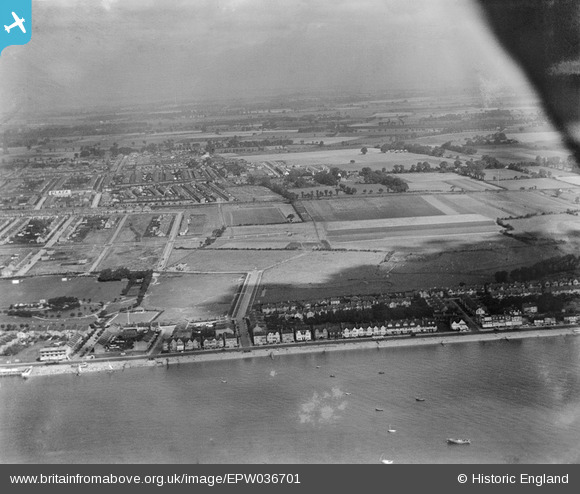
EPW036701 ENGLAND (1931). Housing along the Eastern Esplanade and environs, Southchurch, from the south, 1931
© Copyright OpenStreetMap contributors and licensed by the OpenStreetMap Foundation. 2026. Cartography is licensed as CC BY-SA.
Nearby Images (6)
EPW036701

EPW036703

EPW036753

EPW036752

EPW036754

EPW040979

Details
| Title | [EPW036701] Housing along the Eastern Esplanade and environs, Southchurch, from the south, 1931 |
| Reference | EPW036701 |
| Date | September-1931 |
| Link | |
| Place name | SOUTHCHURCH |
| Parish | |
| District | |
| Country | ENGLAND |
| Easting / Northing | 590212, 184925 |
| Longitude / Latitude | 0.74264368247464, 51.530663435196 |
| National Grid Reference | TQ902849 |
Pins
Be the first to add a comment to this image!
User Comment Contributions
Castleton road, our house opposite the tennis courts, look for the church spire. |

Peacock |
Tuesday 8th of December 2015 11:16:05 PM |