
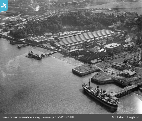
EPW036588 ENGLAND (1931). W.T. Henley's Electric Cable Works, Gravesend, from the north-west, 1931
© Copyright OpenStreetMap contributors and licensed by the OpenStreetMap Foundation. 2026. Cartography is licensed as CC BY-SA.
Nearby Images (19)
EPW036588

EPW036579

EPW036581

EPW032817

EPW032818

EPW036580

EAW031130

EPW036577

EPW032816

EAW031131

EAW031127

EAW031132

EPW036578

EAW028716

EAW031123

EAW028719

EAW031129

EAW031126

EAW031125

Details
| Title | [EPW036588] W.T. Henley's Electric Cable Works, Gravesend, from the north-west, 1931 |
| Reference | EPW036588 |
| Date | September-1931 |
| Link | |
| Place name | GRAVESEND |
| Parish | |
| District | |
| Country | ENGLAND |
| Easting / Northing | 563274, 174584 |
| Longitude / Latitude | 0.34982549581697, 51.446184375031 |
| National Grid Reference | TQ633746 |
Pins

Dylan Moore |
Wednesday 26th of November 2014 09:39:25 PM | |

MB |
Wednesday 26th of December 2012 11:25:16 PM |