
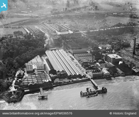
EPW036576 ENGLAND (1931). W.T. Henley's Electric Cable Works, Gravesend, 1931
© Copyright OpenStreetMap contributors and licensed by the OpenStreetMap Foundation. 2026. Cartography is licensed as CC BY-SA.
Nearby Images (26)
EPW036576

EPW032816

EAW031132

EAW031128

EPW036582

EAW031127

EAW031129

EAW031130

EAW031126

EPW036580

EAW031125

EAW031123

EPW032818

EAW031131

EPW036577

EAW028717

EAW028719

EPW032817

EAW028716

EPW036578

EPW036581

EPW036587

EAW028720

EAW031124

EAW028718

EAW042093

Details
| Title | [EPW036576] W.T. Henley's Electric Cable Works, Gravesend, 1931 |
| Reference | EPW036576 |
| Date | September-1931 |
| Link | |
| Place name | GRAVESEND |
| Parish | |
| District | |
| Country | ENGLAND |
| Easting / Northing | 563385, 174297 |
| Longitude / Latitude | 0.35128904335231, 51.443573660484 |
| National Grid Reference | TQ634743 |
Pins

Kentishman |
Friday 23rd of September 2022 04:09:05 PM | |

Dylan Moore |
Wednesday 26th of November 2014 09:43:46 PM | |
|
Dylan Moore |
Wednesday 26th of November 2014 09:42:31 PM |