
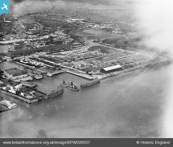
EPW036557 ENGLAND (1931). Outer Basin and No. 1 Timber Pond, Kingston upon Hull, 1931. This image has been affected by flare.
© Copyright OpenStreetMap contributors and licensed by the OpenStreetMap Foundation. 2026. Cartography is licensed as CC BY-SA.
Nearby Images (3)
EPW036557

EAW046143

EPW010811

Details
| Title | [EPW036557] Outer Basin and No. 1 Timber Pond, Kingston upon Hull, 1931. This image has been affected by flare. |
| Reference | EPW036557 |
| Date | August-1931 |
| Link | |
| Place name | KINGSTON UPON HULL |
| Parish | |
| District | |
| Country | ENGLAND |
| Easting / Northing | 511082, 428512 |
| Longitude / Latitude | -0.3155784575097, 53.740917333675 |
| National Grid Reference | TA111285 |
Pins
Be the first to add a comment to this image!