
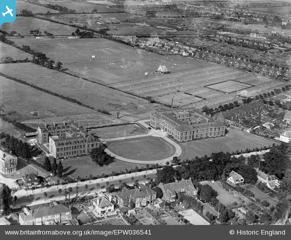
EPW036541 ENGLAND (1931). The University of Hull, Kingston upon Hull, 1931
© Copyright OpenStreetMap contributors and licensed by the OpenStreetMap Foundation. 2026. Cartography is licensed as CC BY-SA.
Nearby Images (5)
EPW036541

EPW036402

EPW036403

EPW036400

EPW036513

Details
| Title | [EPW036541] The University of Hull, Kingston upon Hull, 1931 |
| Reference | EPW036541 |
| Date | August-1931 |
| Link | |
| Place name | KINGSTON UPON HULL |
| Parish | |
| District | |
| Country | ENGLAND |
| Easting / Northing | 507708, 431661 |
| Longitude / Latitude | -0.36561940441591, 53.769920383129 |
| National Grid Reference | TA077317 |
Pins
Be the first to add a comment to this image!