
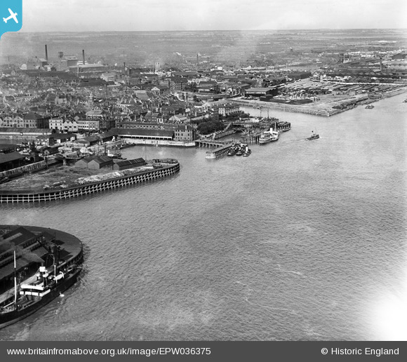
EPW036375 ENGLAND (1931). The Humber Dock Basin, Victoria Pier and the River Humber, Kingston upon Hull, from the south-west, 1931
© Copyright OpenStreetMap contributors and licensed by the OpenStreetMap Foundation. 2026. Cartography is licensed as CC BY-SA.
Nearby Images (3)
EPW036375

EAW004514

EPW036412

Details
| Title | [EPW036375] The Humber Dock Basin, Victoria Pier and the River Humber, Kingston upon Hull, from the south-west, 1931 |
| Reference | EPW036375 |
| Date | August-1931 |
| Link | |
| Place name | KINGSTON UPON HULL |
| Parish | |
| District | |
| Country | ENGLAND |
| Easting / Northing | 509767, 427894 |
| Longitude / Latitude | -0.33572894180963, 53.735642933765 |
| National Grid Reference | TA098279 |
Pins
Be the first to add a comment to this image!