
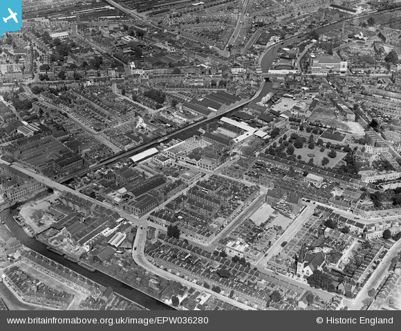
EPW036280 ENGLAND (1931). The Grand Surrey Canal and industrial buildings off Latona Road and environs, Camberwell, 1931
© Copyright OpenStreetMap contributors and licensed by the OpenStreetMap Foundation. 2026. Cartography is licensed as CC BY-SA.
Nearby Images (14)
EPW036280

EPW036282

EPW036284

EPW036277

EPW036279

EPW036283

EPW036285

EPW036278

EPW036281

EPW051541

EPW051540

EPW051544

EPW051542

EPW051543

Details
| Title | [EPW036280] The Grand Surrey Canal and industrial buildings off Latona Road and environs, Camberwell, 1931 |
| Reference | EPW036280 |
| Date | August-1931 |
| Link | |
| Place name | CAMBERWELL |
| Parish | |
| District | |
| Country | ENGLAND |
| Easting / Northing | 534139, 177705 |
| Longitude / Latitude | -0.068014528192455, 51.481886595678 |
| National Grid Reference | TQ341777 |
Pins

LeslyH |
Tuesday 30th of September 2025 05:46:28 PM | |
|
Di |
Sunday 23rd of October 2022 10:26:29 PM | |
|
Di |
Sunday 23rd of October 2022 10:23:43 PM | |
|
Di |
Sunday 23rd of October 2022 10:21:48 PM | |
|
Di |
Sunday 23rd of October 2022 10:19:18 PM | |
|
justgnat |
Wednesday 19th of May 2021 11:15:01 AM | |
|
GT54 |
Thursday 4th of June 2020 07:08:53 AM | |
|
Chris Willis |
Tuesday 25th of June 2013 09:29:20 PM | |
|
Chris Willis |
Tuesday 25th of June 2013 09:13:51 PM | |
|
Chris Willis |
Tuesday 25th of June 2013 08:45:11 PM | |
It seems the main difference is that the broach spire has been reduced to the shorter copper pointed roof. When? |
Chris Willis |
Tuesday 25th of June 2013 08:54:42 PM |
|
Chris Willis |
Tuesday 25th of June 2013 08:20:38 PM | |
|
Chris Willis |
Tuesday 25th of June 2013 08:19:31 PM | |
I have a London atlas from circa 1920 which shows this to be an active gas works at that time. It may be that by 1931 the works had been closed down? |
John W |
Wednesday 28th of September 2016 03:25:34 PM |
|
Chris Willis |
Tuesday 25th of June 2013 08:16:33 PM | |
|
Chris Willis |
Tuesday 25th of June 2013 08:10:56 PM | |
|
Chris Willis |
Tuesday 25th of June 2013 08:09:54 PM | |
|
Chris Willis |
Tuesday 25th of June 2013 08:09:06 PM | |
|
Chris Willis |
Tuesday 25th of June 2013 08:04:51 PM | |
|
Chris Willis |
Tuesday 25th of June 2013 06:50:30 PM | |
|
Chris Willis |
Tuesday 25th of June 2013 06:50:06 PM | |
|
Chris Willis |
Tuesday 25th of June 2013 06:48:56 PM | |
|
Chris Willis |
Tuesday 25th of June 2013 06:48:35 PM | |
|
Chris Willis |
Tuesday 25th of June 2013 06:36:51 PM | |
|
MB |
Tuesday 25th of June 2013 08:57:56 AM | |
|
MB |
Tuesday 25th of June 2013 08:56:24 AM | |
|
MB |
Tuesday 25th of June 2013 08:56:00 AM | |
|
MB |
Tuesday 25th of June 2013 08:55:21 AM | |
|
wessexpig |
Wednesday 1st of May 2013 09:22:58 PM |
User Comment Contributions
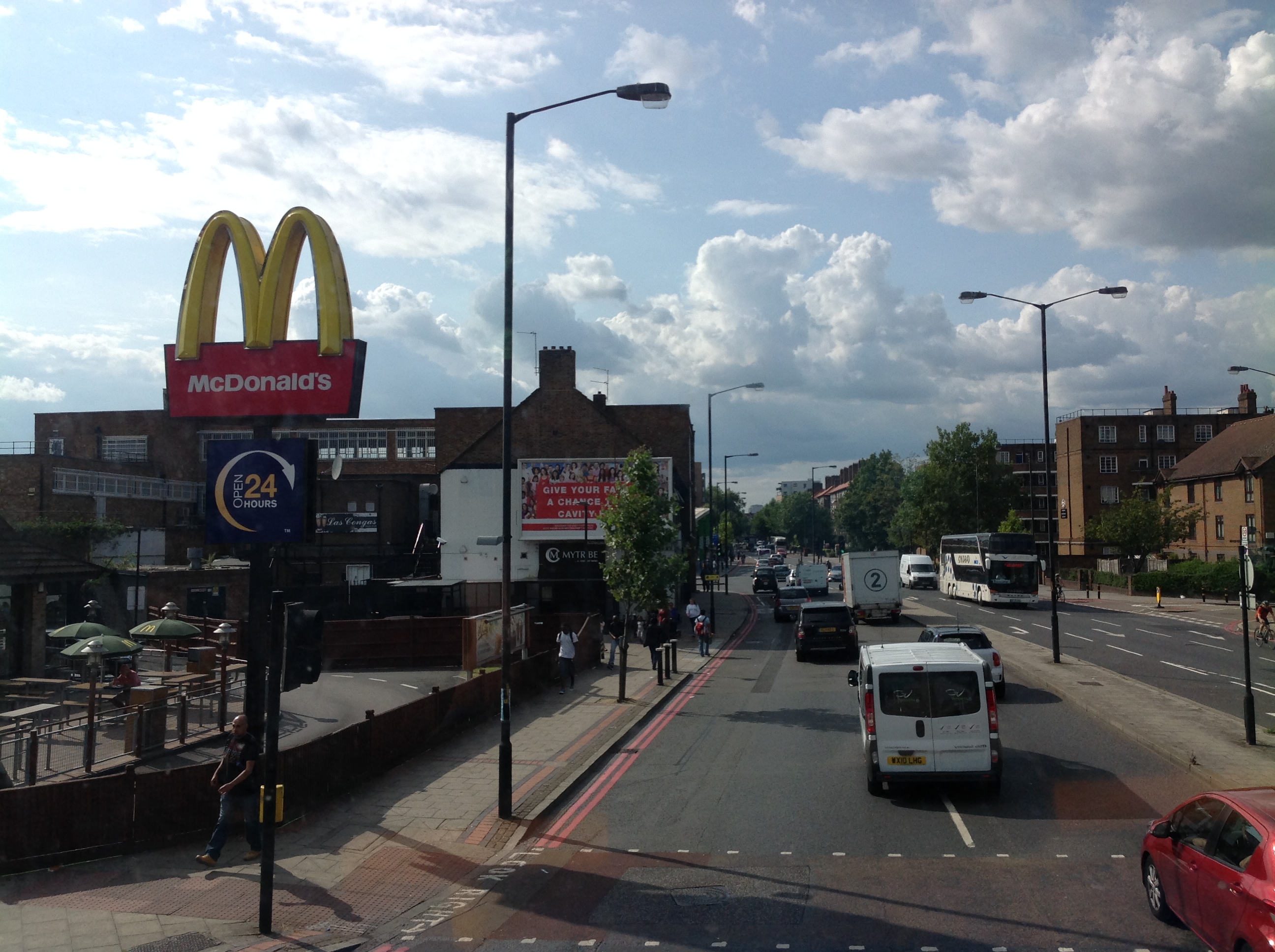
McDonalds at the junction of Old Kent Road and Olmar Street, 04/08/2014. I can't identify anything which is in both photos apart from the alignment of the Old Kent Road. |

Class31 |
Tuesday 5th of August 2014 12:43:23 PM |