
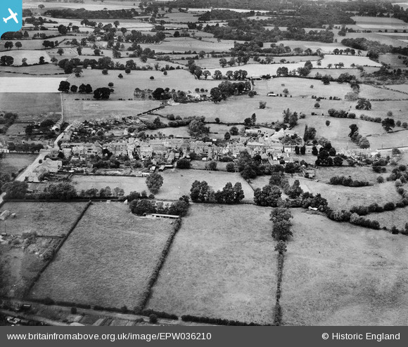
EPW036210 ENGLAND (1931). The village, Theale, from the south-east, 1931
© Copyright OpenStreetMap contributors and licensed by the OpenStreetMap Foundation. 2026. Cartography is licensed as CC BY-SA.
Nearby Images (10)
EPW036210

EAW047231
, Theale, 1952. This image was marked by Aerofilms Ltd for photo editing.")
EAW047229
, Theale, 1952. This image was marked by Aerofilms Ltd for photo editing.")
EAW047226
, Theale, 1952. This image was marked by Aerofilms Ltd for photo editing.")
EAW047228
, Theale, 1952")
EAW047227
, Theale, 1952. This image was marked by Aerofilms Ltd for photo editing.")
EAW047224
, Theale, 1952. This image was marked by Aerofilms Ltd for photo editing.")
EAW047230
, Theale, 1952. This image was marked by Aerofilms Ltd for photo editing.")
EAW047225
, Theale, 1952. This image was marked by Aerofilms Ltd for photo editing.")
EPW036214

Details
| Title | [EPW036210] The village, Theale, from the south-east, 1931 |
| Reference | EPW036210 |
| Date | August-1931 |
| Link | |
| Place name | THEALE |
| Parish | THEALE |
| District | |
| Country | ENGLAND |
| Easting / Northing | 464497, 171115 |
| Longitude / Latitude | -1.07204289658, 51.434867717619 |
| National Grid Reference | SU645711 |
Pins
Be the first to add a comment to this image!