
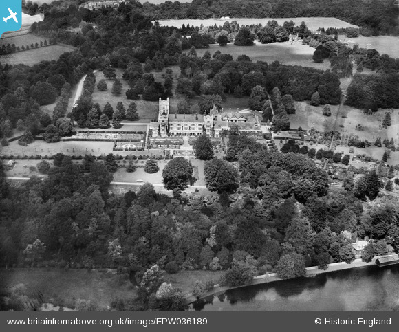
EPW036189 ENGLAND (1931). Danesfield House, Medmenham, 1931
© Copyright OpenStreetMap contributors and licensed by the OpenStreetMap Foundation. 2026. Cartography is licensed as CC BY-SA.
Nearby Images (9)
EPW036189

EAW034261
, Medmenham, 1950. This image has been produced from a print.")
EAW034260
, Medmenham, 1950. This image has been produced from a print.")
EAW045416
, Medmenham, 1952")
EAW045418
, Medmenham, 1952")
EAW045419
, Medmenham, 1952")
EAW045417
, Medmenham, 1952")
EPW036193

EAW045420
 and the surrounding area, Medmenham, 1952")
Details
| Title | [EPW036189] Danesfield House, Medmenham, 1931 |
| Reference | EPW036189 |
| Date | August-1931 |
| Link | |
| Place name | MEDMENHAM |
| Parish | MEDMENHAM |
| District | |
| Country | ENGLAND |
| Easting / Northing | 481625, 184336 |
| Longitude / Latitude | -0.8226034709902, 51.551523454015 |
| National Grid Reference | SU816843 |
Pins
Be the first to add a comment to this image!