
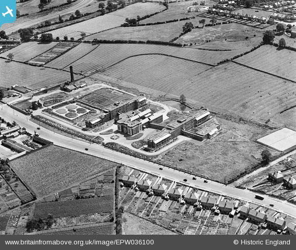
EPW036100 ENGLAND (1931). Derby City General Hospital, Derby, 1931
© Copyright OpenStreetMap contributors and licensed by the OpenStreetMap Foundation. 2026. Cartography is licensed as CC BY-SA.
Nearby Images (7)
EPW036100

EPW036101

EPW036102

EPW036097

EPW036103

EPW036098

EPW036099

Details
| Title | [EPW036100] Derby City General Hospital, Derby, 1931 |
| Reference | EPW036100 |
| Date | July-1931 |
| Link | |
| Place name | DERBY |
| Parish | |
| District | |
| Country | ENGLAND |
| Easting / Northing | 432681, 334940 |
| Longitude / Latitude | -1.5139812133555, 52.910574442022 |
| National Grid Reference | SK327349 |
Pins

BGP |
Monday 6th of October 2014 09:06:26 PM | |
|
BGP |
Monday 6th of October 2014 07:54:36 PM | |
|
BGP |
Monday 6th of October 2014 07:44:43 PM | |
|
BGP |
Monday 6th of October 2014 07:42:16 PM | |
|
BGP |
Monday 6th of October 2014 07:39:29 PM | |
|
BGP |
Monday 6th of October 2014 07:35:45 PM | |
|
BGP |
Monday 6th of October 2014 07:32:42 PM | |
|
BGP |
Monday 6th of October 2014 07:25:08 PM | |
|
BGP |
Monday 6th of October 2014 07:23:21 PM |