
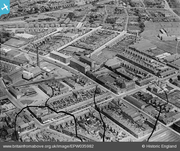
EPW035982 ENGLAND (1931). The Chilprufe Hosiery Mills, St Barnabas Road and environs, North Evington, 1931. This image has been produced from a damaged negative.
© Copyright OpenStreetMap contributors and licensed by the OpenStreetMap Foundation. 2026. Cartography is licensed as CC BY-SA.
Nearby Images (24)
EPW035982

EPW035987

EPW035988

EPW035983

EPW035981

EPW035985

EPW035980

EPW035979

EPW057116

EPW057119

EPW035986

EPW035984

EPW057120

EPW057117

EPW035978

EAW021659

EAW021658

EPW057118

EAW021653

EPW057121

EAW021657

EAW021655

EAW021654

EAW021656

Details
| Title | [EPW035982] The Chilprufe Hosiery Mills, St Barnabas Road and environs, North Evington, 1931. This image has been produced from a damaged negative. |
| Reference | EPW035982 |
| Date | July-1931 |
| Link | |
| Place name | NORTH EVINGTON |
| Parish | |
| District | |
| Country | ENGLAND |
| Easting / Northing | 461055, 304923 |
| Longitude / Latitude | -1.0976560903131, 52.638263220314 |
| National Grid Reference | SK611049 |
Pins
Be the first to add a comment to this image!