
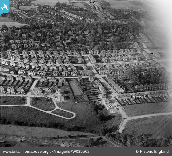
EPW035562 ENGLAND (1931). Housing surrounding Broadmead Road and Mayfair Gardens, Woodford, 1931
© Copyright OpenStreetMap contributors and licensed by the OpenStreetMap Foundation. 2026. Cartography is licensed as CC BY-SA.
Nearby Images (2)
EPW035562

EPW035563

Details
| Title | [EPW035562] Housing surrounding Broadmead Road and Mayfair Gardens, Woodford, 1931 |
| Reference | EPW035562 |
| Date | June-1931 |
| Link | |
| Place name | WOODFORD |
| Parish | |
| District | |
| Country | ENGLAND |
| Easting / Northing | 540483, 191431 |
| Longitude / Latitude | 0.028777318295316, 51.603699289773 |
| National Grid Reference | TQ405914 |
